A Real-time Gaming Framework for IoT and Smart Agriculture Teaching
The Real-time Gaming Framework for IoT and Smart Agriculture is an educational project that introduces the concepts of IoT, sensor integration, MQTT protocol, and real-time data visualization through an interactive game. For source code, visit this GitHub link.
Tutorials
We have integrated tutorials to enhance understanding of remote sensing, GIS, and Machine Learning/Artificial Intelligence.
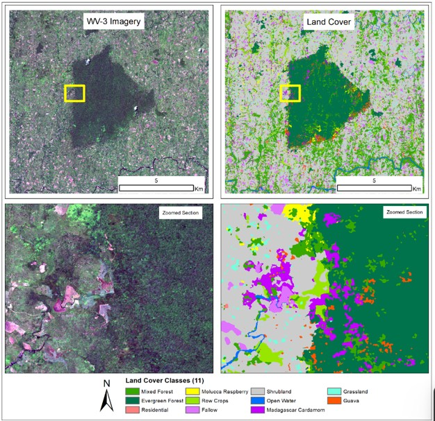
1. Forest Conservation with AI
Learn how machine learning techniques are used to map forest cover in Madagascar.
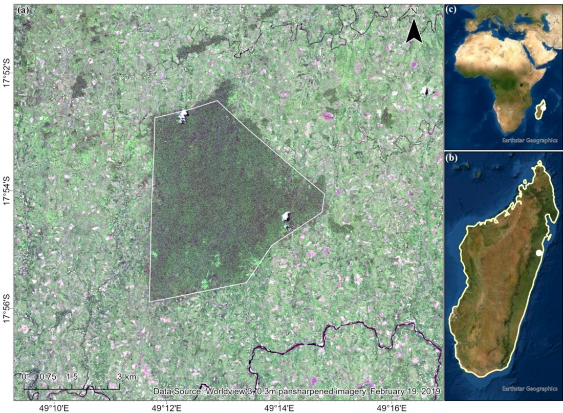
The study area is the Betampona Nature Reserve (BNR), outlined by the white boundary in Figure 1 (a). The BNR is located in the eastern coast of Madagascar; the surrounding areas and the nature reserve make up about 100 square km. This is a species rich area which provides the researchers with a “living laboratory” for the studies of human-forest interactions.
Madagascar houses a lively and diverse ecosystem, but due to encroachment, deforestation tactics (illegal logging), aggressive agricultural practices and urbanization, the environment has greatly altered. Additionally, with the presence of invasive species such as Molucca Raspberry, Madagascar Cardamom, and Strawberry Guava, biodiversity continues to be threatened.
To learn more you can access the tutorial - View Tutorial
2. Water Disparity and Levee Management
Explore water disparity issues and levee management strategies.
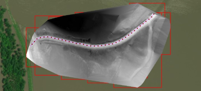
This project was funded and conducted by the MissouriView unit of the AmericaView Consortium to highlight the issue of water equity along the Mississippi River. AmericaView is a nationwide consortium of higher education institutions, industry partners, and educators that work as state-level units to develop and integrate new technologies and methodologies into everyday use.
Typically, issues of water equity are associated with drinking water quality, but in cases of mismatched levee management plans water equity issues also arise when certain levees are managed and upgraded while others are not. In this example, the Len Small Levee in southern Illinois, a 17.2 mile-long levee managed by the local farmer’s bureau protecting $8.79 million of property, 13,500 acres that benefit 1400 local residents. The levee has repeatedly been breached since its construction in the 1940’s, and its reconfiguration in 1982.
To learn more you can access the tutorial - View Tutorial
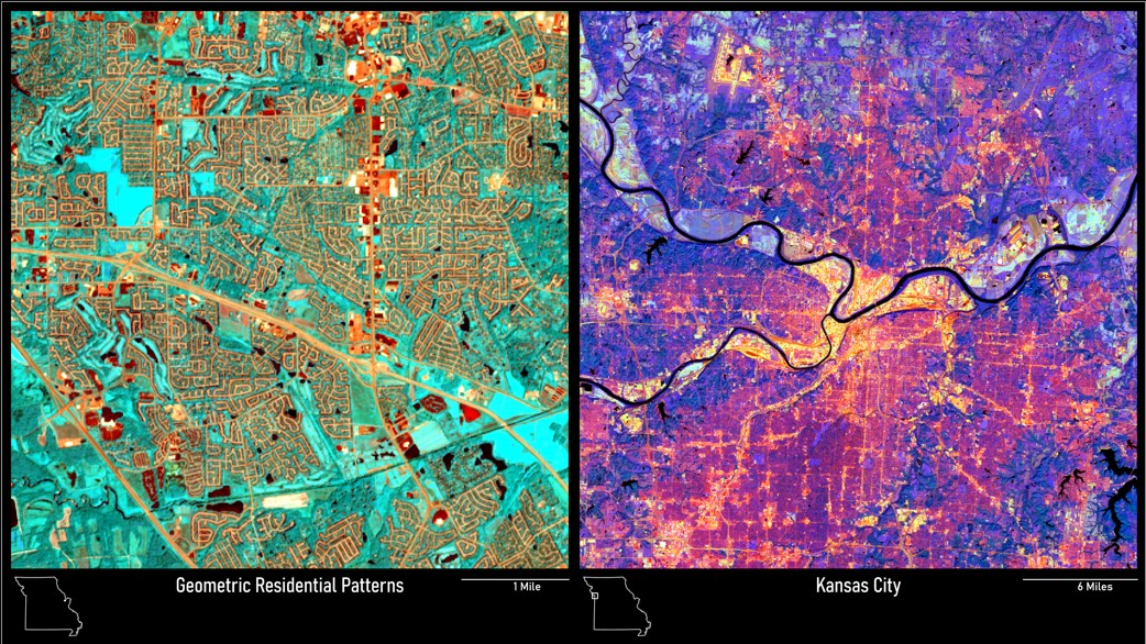
3. Missouri as Art
Visualize Missouri's landscapes using multispectral band combinations.
Missouri is a naturally beautiful state, and one of the most stunning ways to visualize Missouri’s beauty is by using different multispectral band combinations to optimize the visualization of remote sensing data to highlight different features on the ground.
The Missouri as Art portion of MissouriView’s mission makes remote sensing data more visually intriguing and artistic for building interest from K-12 communities, while introducing students to applied concepts in remote sensing.
Material provides introduction to remote sensing with examples of imagery collected in Missouri. With intuitive combination of satellite imagery, the material highlights distinct Missouri landscapes, ideal training material for K-16.